The Colorado River, a vital water source for millions, faces a new management strategy as the Trump administration unveils a decade-long plan to address the region’s increasing water scarcity. Rather than implementing the most severe water restrictions, the administration opts for a more cautious approach, allowing for substantial cuts if conditions demand.
The strategy permits California, Arizona, and Nevada to slash water usage by up to 3 million acre-feet annually, which could equate to losing 40% of their total allocations. However, for the initial two years, the administration has accepted a proposal from these states to reduce consumption by about half of that amount, totaling 3.2 million acre-feet by the end of 2028, thus averting the most drastic cuts for now.
Announced on Friday, the plan allows biennial reviews by the federal government, aiming to mediate between the downstream states of California, Arizona, and Nevada, and the upstream states of Colorado, Wyoming, Utah, and New Mexico. Andrea Travnicek, assistant secretary for water and science at the Interior Department, stated the 10-year plan addresses “unprecedented hydrologic conditions.”
The announcement underscored challenges due to “drought conditions over the past 25 years” and anticipated ongoing dryness, though it notably did not reference climate change as a factor. Nonetheless, scientific studies attribute the harsh conditions to global warming caused by fossil fuels and other emissions, as detailed in a recent report.
The outlined agreement, pending release, projects that by 2028, California will cut its Colorado River water use by roughly 12%, with Arizona and Nevada reducing theirs by 31% and 28%, respectively. The Interior Department acknowledges this as a dynamic strategy to adjust to evolving conditions until 2036.
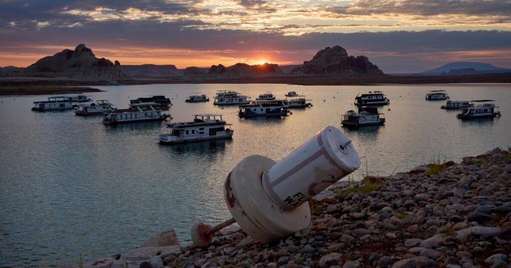
Since 2000, the Colorado River has significantly diminished, and water levels in Lake Mead and Lake Powell have reached historic lows this year, prompting the federal government to establish new management rules as the previous ones expire.
The Trump administration’s plan maintains existing tensions among the states, with potential for legal disputes. Sarah Porter from Arizona State University’s Kyl Center for Water Policy suggests there’s a “good chance” of states challenging the federal plan or engaging in lawsuits against each other.
The Central Arizona Project criticized the plan for “several fundamental legal flaws” and misrepresenting Arizona’s water rights. Governor Katie Hobbs expressed concerns over “unacceptable options” implying federal pressure on Arizona for substantial cutbacks.
Currently, the Colorado River sustains about 35 million people and 5 million acres of farmland. Originally divided under a 1922 compact, the water allocation has seen the lower states using 49%, upper states 29%, while evaporation and Mexican usage account for the remainder.
Over the subsequent two years, the U.S. Bureau of Reclamation will not mandate water reductions for the upstream states, with financial support allocated from the Biden-era Inflation Reduction Act providing $350 million to lower states and $100 million to upper states for conservation efforts.
Agriculture, which consumes about three-quarters of the river’s water, remains a focal point in the conservation strategy. The administration’s plan is documented in a final environmental impact statement, with further details forthcoming in a record of decision and guidelines for 2027 and 2028.
California’s Colorado River commissioner, JB Hamby, remarked, “This is an important milestone, but it is not the finish line.” The state has already reduced its river water usage to its lowest since 1949, agreeing to further reductions due to the river’s declining reliability.
Southern Californian cities derive nearly a quarter of their water from the river. The Metropolitan Water District, serving around 19 million people, acknowledged the plan’s significance but criticized the lack of upstream state involvement in water reductions, urging a collective effort among all seven states and Mexico.
Historical data indicates the river’s flow has decreased by 32% since the 20th century, with climate change accelerating the Southwest’s aridification. Scientists estimate higher temperatures account for approximately half of the river’s diminished flow, predicting a 9% decrease in flow for every 1.8°F temperature rise.
This year, the Rocky Mountains experienced the lowest snowfall on record, a situation linked to climate change, which a recent study suggests is now 14 times more likely than pre-Industrial times. Researchers advocate for emission reductions to mitigate such risks, as published in the journal PNAS.
Original Story at www.latimes.com